
Madison Neighbors Across Public Sources
No Madison source publishes a complete household list for a block. DCiMap supplies the shape and setting of nearby parcels. City and county property searches add owner and tax context. The voter system is built to confirm an individual registration, not to browse everyone on a street. City-recognized neighborhood groups identify the civic organization around an address, while printed reverse directories offer a historical view.
| Source | What It Shows About a Block | Access |
|---|---|---|
| Dane County DCiMap | Parcel boundaries, aerials, roads, districts, buffers, and selected map attributes | Free interactive map and help pages |
| City Assessor and Access Dane | Owner index, situs address, parcel ID, tax, assessment, zoning, and district context | Free, one parcel or result list at a time |
| Wisconsin voter systems | An individual match or paid data request with protected fields removed | MyVote confirmation or Badger Voters request |
| Neighborhood organizations | Group name, boundary, plans, and public contact, not member households | City directory and organization sites |
| Reverse directories | Past occupant or telephone leads arranged by address | Madison library and historical collections |
A recorded owner may live elsewhere, and a tax mailing address is not the same as a parcel's situs address. Access Dane reports that roughly 97 percent of owner information is published because an opt-out path exists. County data can also lag after Madison software changes, so current city property status should be checked with the City Assessor. These limits matter before attaching a person's name to the house next door.
Map Madison Neighbors in DCiMap
The Dane County DCiMap is the strongest geographic starting point. Its layers cover parcels, aerial images, district boundaries, environmental details, and historic material. An address search can select a parcel automatically. From there, read the parcels sharing a side or rear boundary and those across the street. Roads and lot lines explain which properties truly form the immediate block.
Version 7.0 help dated May 2026 documents address-to-parcel selection, reverse geocoding, filters, drawing tools, transparency, exports, and print-scale controls. Earlier 2025 release notes mention highlighted buffer selections, mailing-label output, CSV export, building numbers, and resident or non-resident label modes. Controls can change, so compare the live viewer with the official DCiMap help.
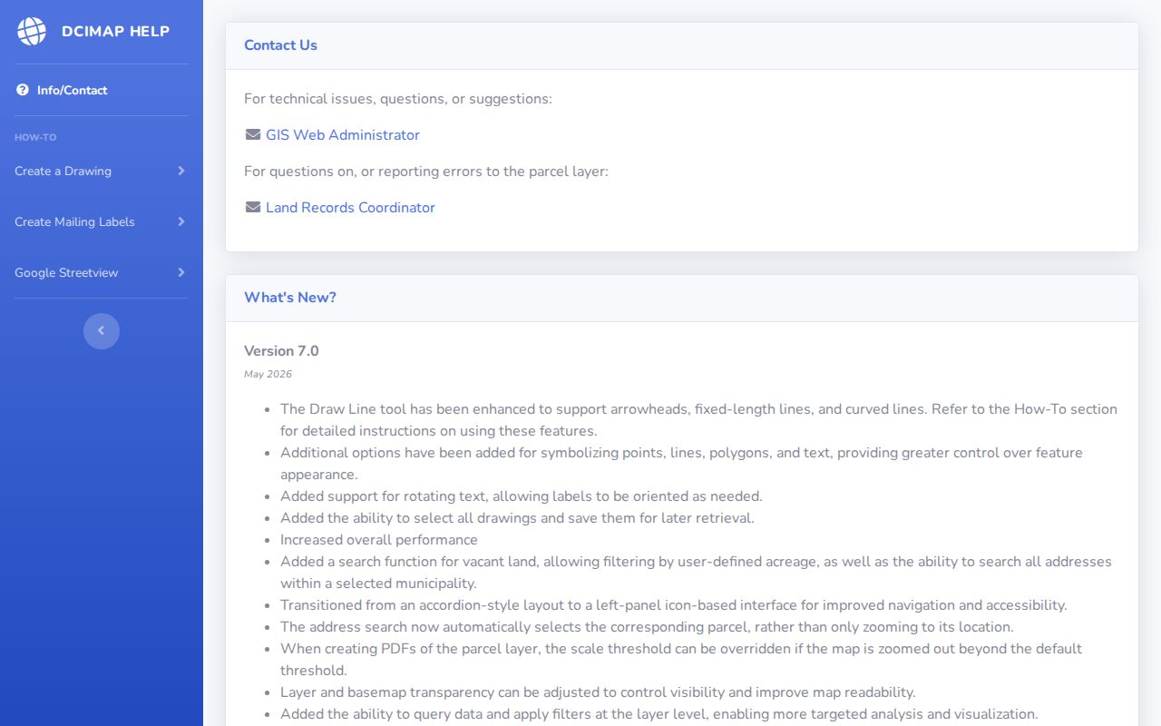
The captured help screen is useful for finding the current tool names. The map remains a geography aid, not a verified roll of everyone nearby.
Walk a Madison Block by Parcel
Use a tight radius. A whole named street can cross many neighborhoods and thousands of parcels, while neighbor research usually concerns the lots touching one address. Capture the subject parcel number first, then move clockwise around the block. Confirm each selected shape through the property portal rather than assuming that a map label is current.
- Search the center address in DCiMap and save its parcel number.
- Select each adjoining parcel, including rear lots and parcels across the road.
- Open the Madison Assessor search for current city owner and address information.
- Use Access Dane for tax, assessment, zoning, school, municipal, and technical-college district context.
- Mark owner names as owners, not assumed occupants, and date every result.
The assessor accepts a house number and street name, with optional direction, street type, and unit. Its address-range form can help when several nearby lots share one street. Access Dane permits partial address and parcel searches but warns that broad result lists can reach a maximum count. For a full road rather than a compact block, use the Madison street directory method.
Note: A shared parcel edge is a sound map fact; shared ownership, occupancy, or association membership requires separate evidence.
Madison Neighborhood Groups by Address
The City of Madison neighborhood organization directory is the right bridge from a parcel to civic life. The city tells users to identify an organization through its address mapping tool. The result can supply a group name, boundary, planning context, and a public contact. It is not a membership list and does not prove that a nearby household participates.
City Neighborhood Directory
Use an address to locate recognized groups and boundary information. Treat contacts as civic points of contact.
Third Lake Ridge
The historic district and neighborhood resources add preservation and house-history context to nearby parcels.
Dane County Historical Society
Appointment-based archives hold plat maps, architectural drawings, oral histories, and local collection leads.
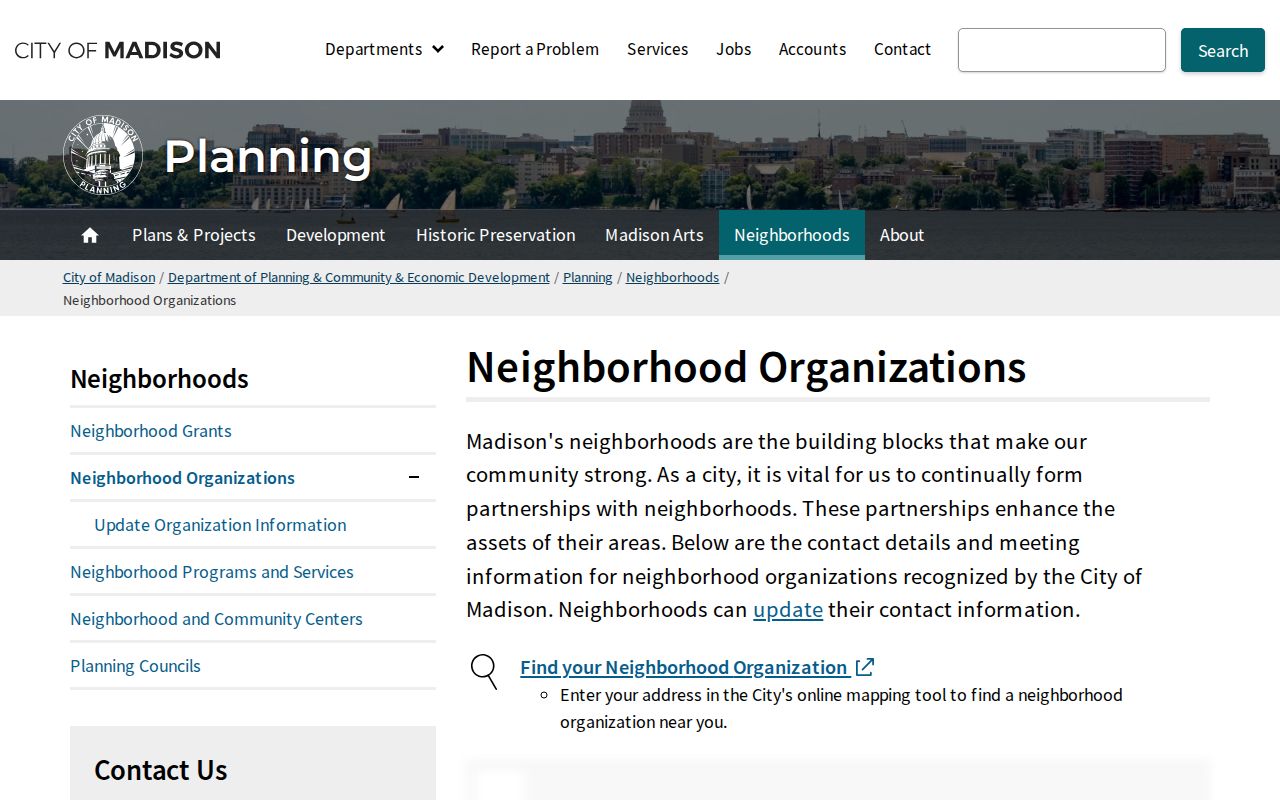
The directory screen helps connect an address to an organized neighborhood. Contact a group about public meetings or published plans, not for private member information.
Madison Neighbors and Voter Data
Wisconsin MyVote asks for a first name, last name, and date of birth to find an individual registration. It is not a street-wide neighbor roster. Wisconsin voter information is governed chiefly by Wis. Stat. §6.36, and protected fields or confidential electors are excluded from ordinary public display.
Badger Voters offers a separate quote, payment, and download path for voter data requests, with election and district filters. Its files still do not prove that every person at a Madison address appears. Eligibility, registration status, recent moves, and confidentiality rules all affect coverage. Do not turn a no-match into a claim that a person does not live nearby.
Privacy quirk. Wisconsin Safe at Home can substitute an assigned address while the clerk privately retains an eligible voter's actual location.
Historic Madison Neighbors in Print
Reverse directories let an old address lead to an occupant or telephone listing, especially in later printed years. Madison Public Library keeps city directories and newspaper microfilm at Central Library. HeritageQuest adds census images, directories, local histories, and land-ownership plats. A directory is a dated snapshot, not proof that every member of a household was listed.
For address changes, the Wisconsin Historical Society's Frank Custer Local History Research Files are unusually local. The 52-box collection includes Madison subject cards, house cards, street names, and street-name origins. DCHS and Historic Madison oral histories preserve more than 60 interviews recorded in the 1980s through 1991, including Third Lake, downtown, Bush, Regent, and Latin Quarter topics. These sources explain how neighbors described a place, but current identity still needs a current source.
Madison Block Permits and Cases
Madison's Accela portal advertises public research for permits, code-enforcement cases, licenses, reported problems, contracts, and address-linked inspection categories. Use the same exact address formats captured from the assessor. The research did not confirm every search-field label because the portal blocked inspection, so do not assume filters that are not visible on the live screen.
Permit activity can date work on a structure or show that a city case touched the address. It does not name every neighbor or prove who occupied the building. For municipal court material related to building code or other ordinance matters, the Madison Municipal Court has a separate records-request route and access limits.
Official Madison Records or Tools
Official rolls are narrower than commercial neighbor tools, but their custody and fields are clearer. Commercial results may blend stale addresses, namesakes, and inferred relatives. Use them only as unverified hints, never as the final word about a nearby person.
| Source type | Best use | Main limit |
|---|---|---|
| Official parcel and map records | Lot, owner index, tax, district, and geographic context | Owner is not always occupant |
| Neighborhood organizations | Boundaries, plans, meetings, and public civic contacts | No public household roster |
| Commercial lookup category | Possible spelling or former-address lead | Unclear sourcing, stale merges, and paywalls |
Protect Privacy of Madison Neighbors
Parcel records omit many renters and household members. Utility, delivery, and private association data are not general public directories. Owner opt-outs and Safe at Home protections can also hide a name or replace an address. Search results should describe the field actually shown, such as recorded owner, mailing contact, registered voter match, or organization boundary.
Wisconsin's public records law allows requests for existing records that reasonably describe a subject and time span. It does not force a custodian to create a fresh list, and statutory or common-law exceptions still apply. A denial should give its legal basis. Ask for a defined record rather than demanding the names of everyone around an address.
Lawful use. Learn about Madison neighbors for civic contact, local history, reconnecting, or personal safety. Never use a record to watch, intimidate, stalk, or harass anyone.