
Walk a Madison Street Address
A Madison street directory search works best as a chain, not as one broad query. The City Assessor identifies the current parcel and indexed owner. Dane County tools add tax, zoning, district, map, and recorded-document context. Historical directories can then supply names tied to the address in a particular year. Each source answers a different question, so record the date and exact form of the address at every stop.
Start with the smallest useful fact: the full house number, direction, street name, suffix, and unit. Keep the owner name separate from the people who may occupy the site. A parcel result establishes an ownership record, while a directory entry is dated evidence that a name was printed at an address. Neither alone proves a complete household.
- Enter the exact address in the City of Madison Assessor search. Use its address-range form when the question covers several numbers.
- Place the result in DCiMap. Confirm the parcel shape and collect adjacent parcel numbers only when block context is relevant.
- Cross-check the parcel in Access Dane. Note its legal description, tax district, zoning, and any warning about stale Madison data.
- Use the current owner's name and legal description in the Dane County deed index. Follow each grantor, the seller, and grantee, the buyer, backward.
- For a dated occupant, consult a reverse directory by address, then check the name in the alphabetical part of the same volume.
This address-to-parcel-to-deed method keeps similar street names and repeated surnames from being merged. If the goal becomes one named person rather than the full street, the Madison resident search uses a different verification path.
Search Madison Streets by Range
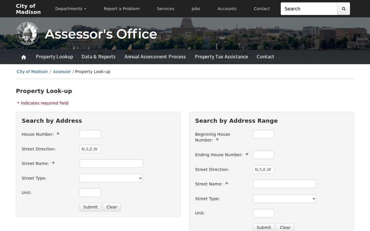
The City Assessor property search is the closest official tool to a modern street directory. Its single-address form can separate units. The range form can return parcels between two house numbers on one street. Owner-last-name and parcel-number forms offer a second route when the address is incomplete.
| Assessor form | Required input | Optional detail | Format note |
|---|---|---|---|
| Address | House number, street name | Direction, type, unit | Street name allows 35 characters |
| Address range | Beginning and ending numbers, name | Direction, type, unit | House-number fields allow five characters |
| Last name | Owner's last name | Partial or full name | Field allows 35 characters |
| Parcel number | Parcel number | None stated | Form shows a 12-character example |
Copy the situs address, meaning the location of the parcel, exactly as shown. Also preserve the parcel number, assessment year, classification, acreage, values, zoning, map links, and legal-description references when present. A live City Assessor result was not captured in the research, so do not assume that every result displays every field.
Use the photographed Madison Assessor search forms as a field guide before typing an address.
Madison Street Directory Sources
No public office keeps a complete list of everyone on a Madison street. These address-keyed sources can be combined without treating owners, voters, or directory names as interchangeable. The keeper and access method also show where to ask when a web search fails.
| Record Set | Keeper | What It Shows | Access |
|---|---|---|---|
| Property roll | Madison Assessor | Indexed owner, situs, parcel, value | Free city search |
| Parcel and tax file | Access Dane | Legal description, tax, zoning, districts | Free portal; owner opt-outs exist |
| GIS parcel map | Dane County LWRD | Geometry, aerials, nearby parcels, districts | Free DCiMap viewer |
| Recorded instruments | Dane Register of Deeds | Deeds, mortgages, liens, plats, CSMs | Online index, office, paid copies, mail |
| Permits and cases | City of Madison | Address-keyed building and code activity | Public Accela research route |
| Historical directories | Library, UW, WHS | Dated occupant and phone leads | Scans, databases, shelves, microforms |
MyVote is not a by-street roster. It requires a name and date of birth for an individual match. A broader Wisconsin voter-data request goes through Badger Voters and may be filtered by municipality or ward, but protected fields and confidential-elector rules still apply. It also never reveals how anyone voted.
Map Madison Streets in DCiMap
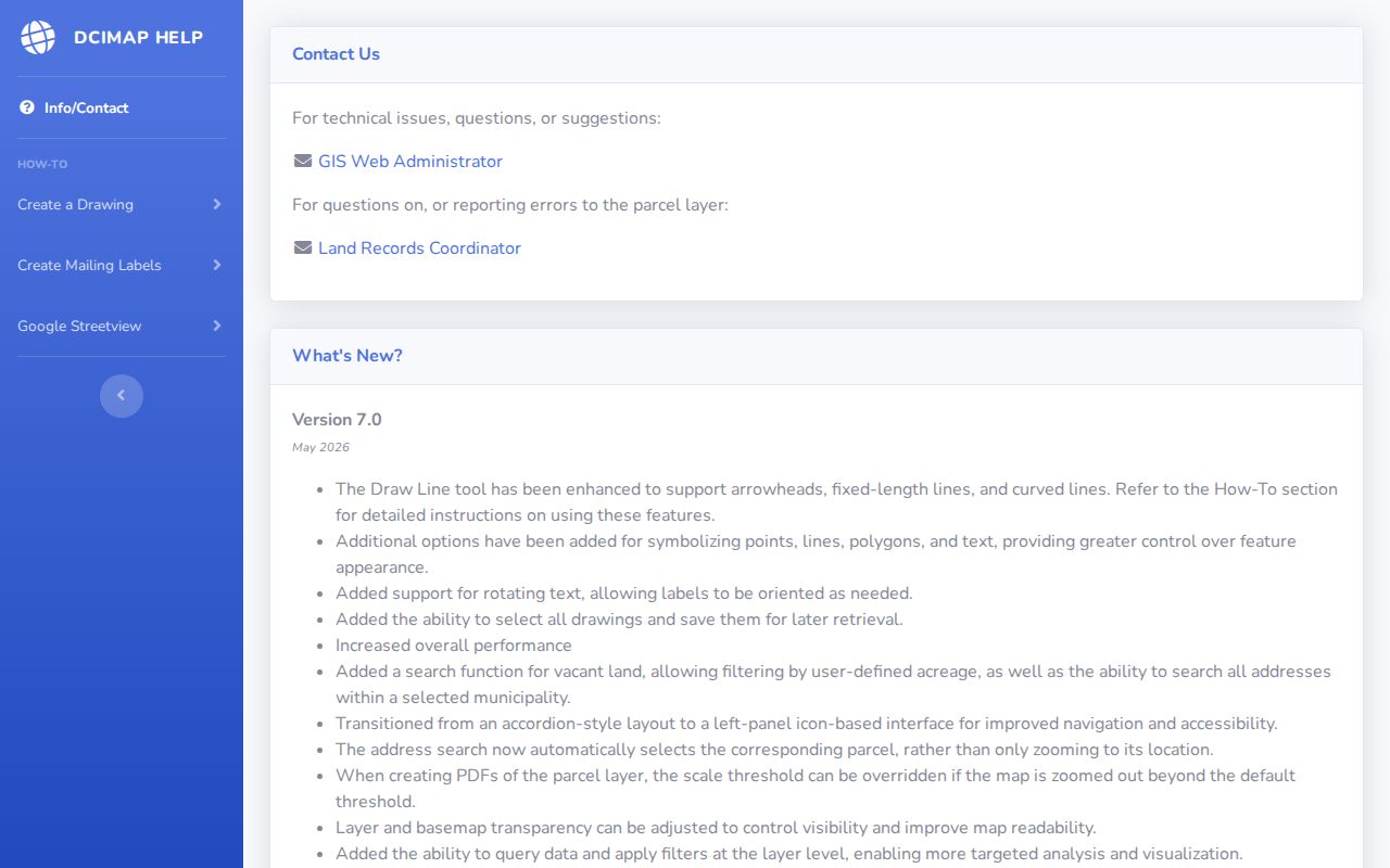
Dane County DCiMap turns a typed address into geographic context. Version 7.0, documented in May 2026, can select a parcel from an address, run municipality and vacant-land searches, query or filter layers, adjust transparency, reverse-geocode a point, and export or print a map. Parcel, aerial, district, water, wetland, soil, and elevation layers can explain why one street crosses several record boundaries.
The map is not an owner-name search. Click a parcel, record its identifier, and take that number to Access Dane or the City Assessor. Recent release notes also describe highlighted buffer selections and some mailing-label or CSV outputs. Those tools help define an area; they do not turn the result into a verified list of residents.
The DCiMap help screen documents the current parcel and export tools.
Note: A selected map shape establishes parcel geography, not who occupies a building.
Follow Madison Deeds by Address
The Dane County Register of Deeds index is searched by party and legal description, not as a simple street list. Begin with the current indexed owner. Open the purchase instrument when an image is available, note the grantor and grantee, and retain the exact legal description. Then search the seller as a buyer in an earlier transaction. Condominium plats, subdivision plats, and certified survey maps may explain why one address now represents several parcels.
Online dates require care. The search page says the index begins in January 1975, while county copy instructions say records from 1972 forward may be searched online. Back-indexing is ongoing. A missing hit during that overlap calls for confirmation at the City-County Building rather than a claim that no instrument exists.
- Parcel
- A mapped unit of land identified by a county or city number.
- Situs address
- The physical property location, which can differ from the tax mailing address.
- Plat
- A recorded map that divides land into lots, blocks, streets, or condominium units.
- Criss-cross directory
- A directory arranged by street and house number instead of only by surname.
Madison Deed Search Fallbacks
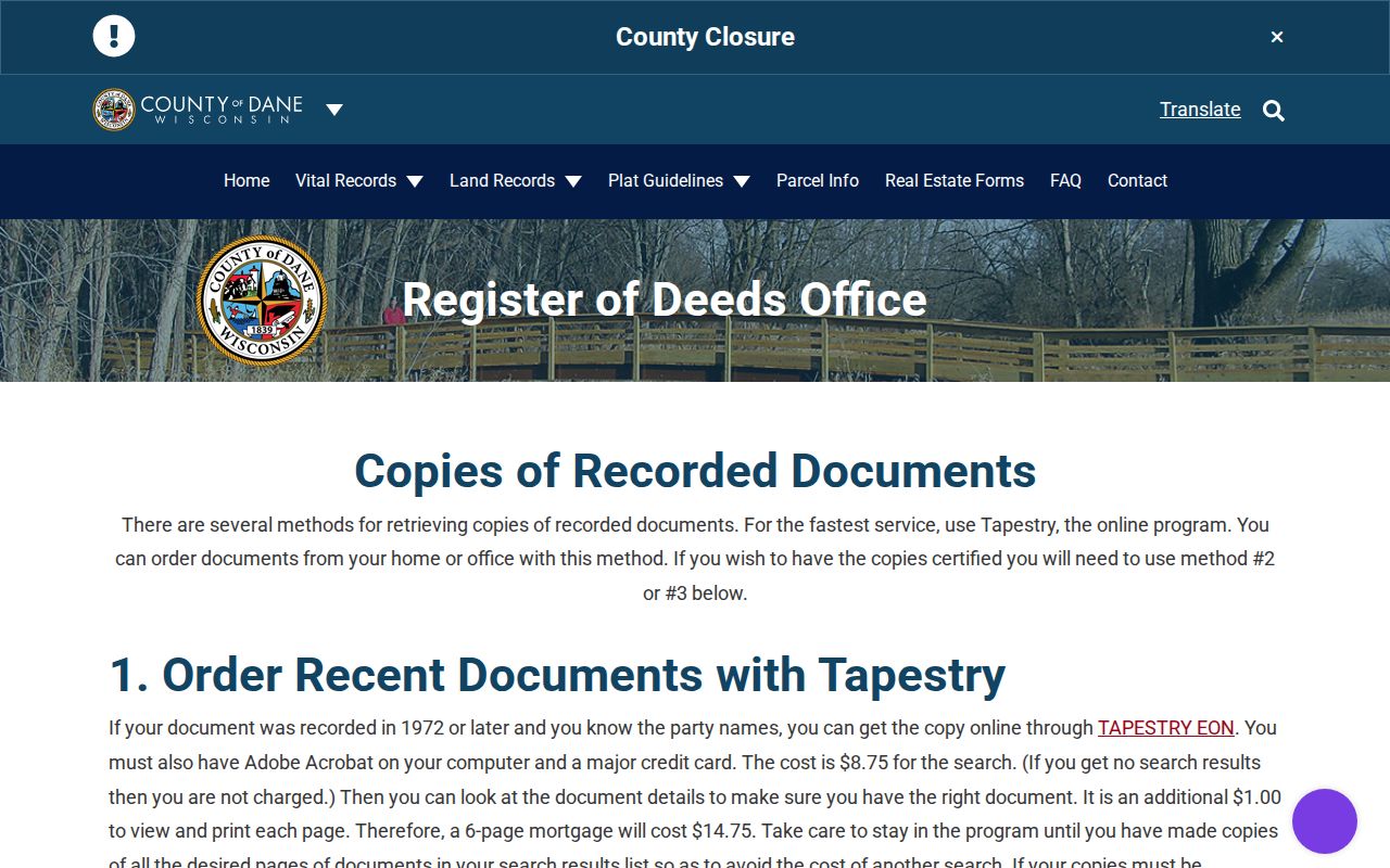
Several access channels remain when the online deed search gives no result. Most records may be viewed free in the Register of Deeds office at the City-County Building. Office copies cost $2 for the first page and $1 for each added page, with $1 added per certified document. The office path is cash only according to the copy page.
The county's copy instructions list an $8.75 online search charge even when nothing is found, plus $1 for each viewed or printed page. A mail request needs a document number or volume and page, the year and page count, a money order, and a self-addressed stamped envelope. The stated mail time is about two weeks. Tapestry EON serves occasional users, while Laredo Anywhere is aimed at frequent title work.
The captured county copy page shows the identifiers and payment paths before an order begins.
Reverse Madison Street Directories
A reverse directory turns an old Madison address into a name or telephone lead. Later volumes may arrange streets alphabetically and house numbers in order. After finding an address, move to the alphabetical section in the same year. That second entry may supply a spouse, occupation, employer, or spelling variant that separates people with the same surname.
Madison Public Library keeps city directories in the Central Library Local History Room and Local Materials section at 201 W Mifflin Street. UW Digital Collections offers Madison scans advertised for 1858 through 1921. HeritageQuest adds a national directory corpus dated 1821 through 1989, usually through library access. The full historical shelf and entry notation belong to the Madison city directory collections.
Note: Reverse sections are year-specific and incomplete; absence from one volume does not prove that a person had left Madison.
Madison Permits Along a Street
The City's Accela portal advertises public research for permits, license records, permit applications, code-enforcement cases, reported problems, and address-based inspection categories. An account with a valid email is needed to submit an application, but the public research route is distinct from filing. Exact search labels were not available during research, so use the current portal prompts rather than guessing at a field.
Permit records describe work or municipal activity at a site, not everyone who lived there. Compare the record date with the parcel owner and deed date. A contractor, applicant, business holder, or prior owner named in a filing may not have occupied the address.
When Madison Street Numbers Fail
Street numbers, quadrant labels, and municipal boundaries can shift across historical sources. The research confirmed a City property-numbering document but did not establish a full renumbering chronology. Do not invent a conversion. Compare the old directory with a map from the same period, a plat, a legal description, and nearby cross streets.
The Wisconsin Historical Society's Frank Custer Local History Research Files offer an unusually local fallback. The 52-box card collection includes Madison subjects, houses, street names, and street-name origins; boxes 57 through 59 cover street names from A to Z. Those manual cards can bridge a failed modern search. Dane County's project to digitize more than 500 mapped land records from 1937 through 1969 may also help around west Madison, Shorewood, and Midvale, though the currently searchable subset should be checked on the county project page.
Limits of Madison Street Records
A street directory result is not a complete household list. Parcel files emphasize ownership. Renters, relatives, visitors, and other occupants may never appear. Access Dane says owner publication is below complete because owners may opt out. A tax mailing address may be outside Madison and does not prove where its recipient lives.
Wisconsin MyVote is a name-and-date-of-birth match, not a public street browser. Safe at Home can substitute an assigned address for an eligible confidential elector while the clerk retains the actual address privately. Driver data is restricted by state and federal privacy rules. Utilities and delivery data are not substitutes for an official public roll.
Lawful use. Use Madison address records only for lawful personal research, property history, and civic questions. Never use them to stalk, harass, intimidate, or harm anyone.
A blank result can reflect a protected record, opt-out, missing year, unindexed field, stale county feed, or a person who is not the owner. Verify the source date and contact the named custodian before drawing a conclusion.